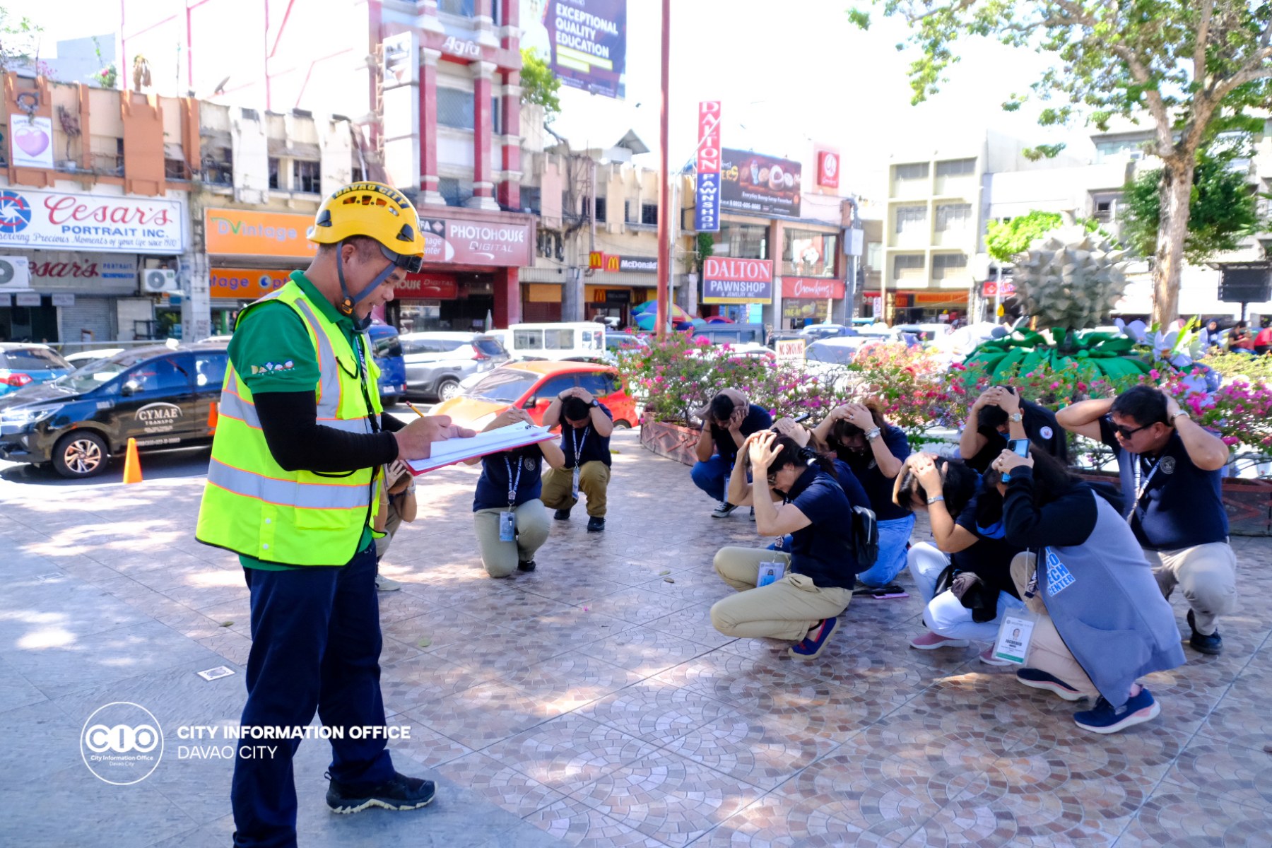
The Davao City Disaster Risk Reduction Management (CDRRMC) is bracing for the possible impact of Tropical Storm Odette, which is forecast to intensify into a Typhoon, including flash floods and rain-induced landslides in some areas of the city.
CDRRMO head Alfredo Baloran, during the Odette Pre-Disaster Assessment (PDRA) meeting via zoom on Tuesday afternoon, said that although the direction of the Tropical Storm is not toward the city, barangay officials, volunteers, and the response cluster are urged to prepare for its possible effect as the city is still affected by the trough or extension of the looming typhoon.
“Sa tanan volunteers and response clusters, especially sa security cluster, ginahangyo mo namo nga we have to prepare our resources. Mag-andam ta tanan (To all volunteers and response clusters, especially the security cluster, I encouraged you to prepare your resources. Let’s be prepared),” he said.
For the barangay officials, he told them to ready their evacuation centers in case the situation worsens and ready another site should the number of evacuees exceeds the capacity of their first evacuation sites to ensure social distancing.
In his report, Lyndon Ancajas, CDRRMO administration and training chief said that an advisory has been disseminated to alert action officers and responders in the city on the possible impact of the Severe Tropical Storm, which includes flash floods or landslides during severe thunderstorms.
Ancajas said that based on the risk assessment released by the National DRRMC on December 13, Davao city was placed under Medium Risk. With this, for the Emergency Preparedness (EPR) protocol, the local DRRMC must send warnings and advisories which the city has done already; cascade preparedness directives; preemptively evacuate; activate Emergency Operations Center (EOC) to Blue Alert; activate selected-response clusters; preposition resources; provide advance augmentation, and release a situational report.
The CDRRMC advised all the response clusters, including Barangay DRRMC and volunteer responses, to closely monitor their areas of responsibility for the possible impacts of the impending hazard.
Ancajas also advised residents dwelling near mountain slopes and those in the low-lying areas to be alert for possible flashflood, street-flooding, and rain-induced landslides.
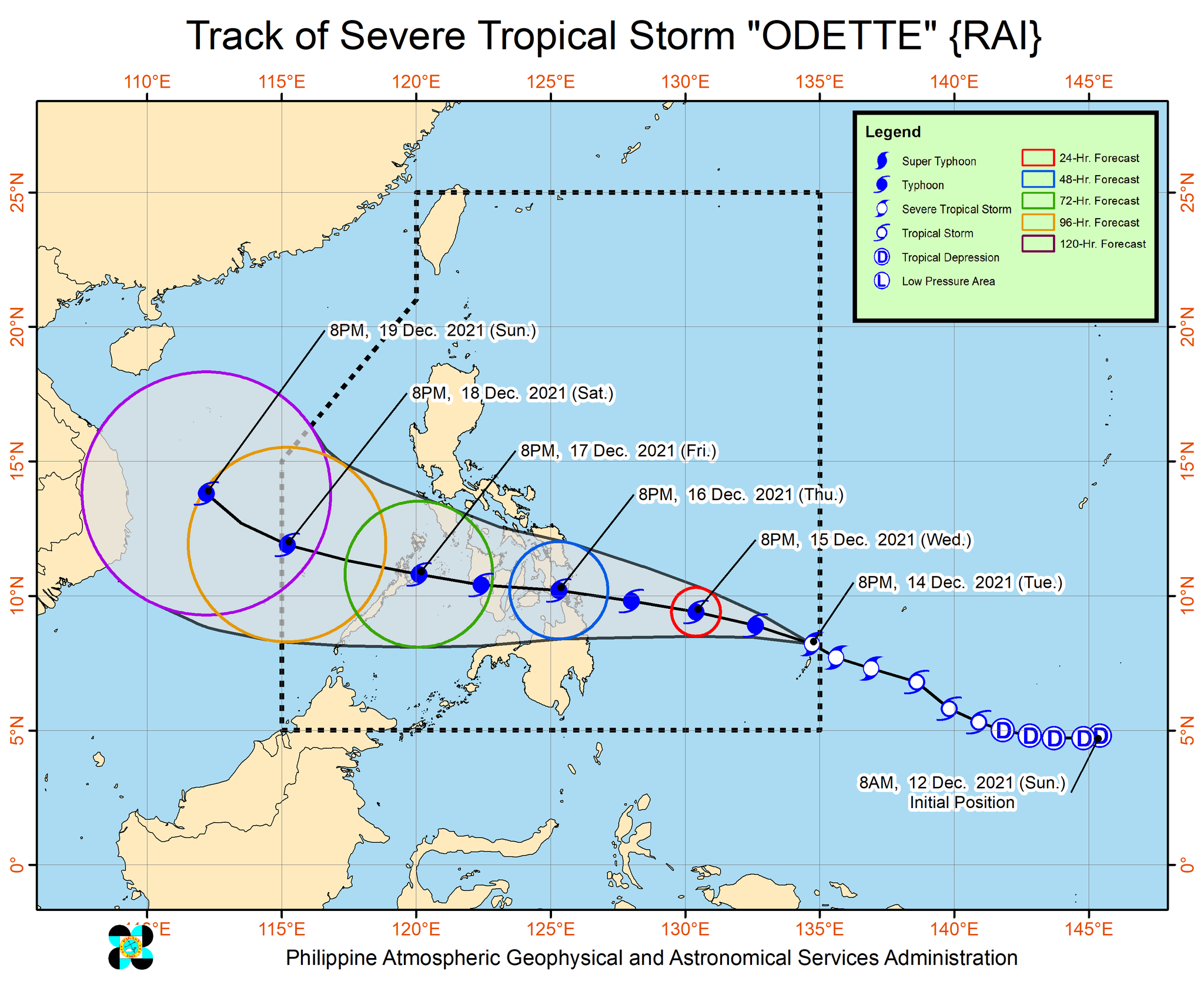
In a weather update, Hannah Salvador of the Philippine Atmospheric, Geophysical and Astronomical Services Administration (PAGASA) said that the Tropical Storm may intensify further into a typhoon before landfall in the vicinity of Caraga or Eastern Visayas by Thursday afternoon, December 16.
“In the next 24 hours, the trough of Severe Tropical Storm ‘Rai’ will bring light to moderate with at times heavy rains over Caraga and Davao Oriental,” she said, adding that this may bring heavy to torrential rainfall over the Visayas, Mindanao, and several provinces in Southern Luzon.
With this, she further said, inundation due to high waves near the coastal areas and storm surge is highly possible for low-lying localities and storm surges are also possible for low-lying localities and along the path of the typhoon.
Based on the weather forecast, as of 3 PM, Severe Tropical Storm Rai is located at 1,000 Km East Of Mindanao (7.8°N, 135.4°E) (Outside Par) with maximum sustained winds of 100 Km/h and gustiness up to 125 Km/h. Moving West Northwestward at 25 m/h.
The trough of Severe Tropical Storm Rai is affecting the Davao Region.
“Davao City is experiencing cloudy skies and may have scattered rain showers and thunderstorms caused by the Trough of Severe Tropical Storm Rai [triggering] light to moderate winds from Northeast to North with slight to moderate seas,” the weather forecast said.CIO

